The physical duration of a total solar eclipse is dictated entirely by a non-linear optimization problem involving three variable celestial distances and their resulting angular velocities. On August 2, 2027, this geometric system will yield a duration of totality reaching 6 minutes and 23 seconds. While the 21st century contains one longer eclipse—the event of July 22, 2009—that baseline achieved its maximum duration of 6 minutes and 39.5 seconds over the open waters of the Pacific Ocean and a remote, restricted island. The 2027 event represents the longest total solar eclipse on easily accessible landmasses until June 3, 2114.
Maximizing the duration of an observer’s time within the Moon’s umbral shadow requires minimizing the apparent size of the solar disk while maximizing the apparent size of the lunar disk, alongside an optimization of the observer's rotational velocity relative to the shadow's path. Evaluating the underlying physics reveals the mechanics of this anomaly and the specific logistics required to exploit it.
The Tri-Factor Velocity and Distance Framework
The duration of a total solar eclipse at any given terrestrial coordinate is determined by the instantaneous width of the umbral shadow and the relative velocity at which that shadow sweeps across the Earth's surface. This relationship is quantified by the three core orbital mechanics phenomena outlined below.
1. Solar Apparent Diameter Minimization via Aphelion Proximity
The Earth's orbit around the Sun follows an ellipse with an eccentricity of approximately 0.0167. When the Earth reaches aphelion—its furthest point from the Sun, occurring annually in early July—the solar distance expands to approximately $1.521 \times 10^8 \text{ km}$. This maximizes the denominator of the Sun’s angular diameter calculation:
$$\theta_{\text{sun}} = 2 \arctan\left(\frac{R_{\text{sun}}}{D_{\text{sun}}}\right)$$
By scheduling the eclipse event in early August, the Earth remains close enough to aphelion that the apparent size of the solar disk is near its absolute annual minimum, measuring roughly 31.5 arcminutes. This minimizes the area of the sky the Moon must obscure.
2. Lunar Apparent Diameter Maximization via Perigee Convergence
Conversely, the Moon’s orbit around the Earth exhibits a higher eccentricity of approximately 0.0549. The lunar apparent diameter is maximized when the syzygy (alignment) occurs precisely at perigee, the point of closest approach. During the August 2, 2027 event, mid-eclipse occurs a mere 2.5 hours prior to lunar perigee, reducing the Earth-Moon distance to nearly its absolute minimum. This expands the lunar apparent diameter to approximately 33.8 arcminutes, generating a substantial geometric overlap, or magnitude of eclipse, calculated at 1.079.
3. Rotational Velocity Synchronization at Low Latitudes
The linear speed of the Moon’s shadow in space travels eastward at roughly 3,400 km/h relative to the center of the Earth. The Earth itself rotates eastward, with the linear velocity of its surface being a function of latitude:
$$v_{\text{surface}} = v_{\text{equator}} \times \cos(\text{latitude})$$
At the equator, this velocity reaches approximately 1,670 km/h. To maximize totality, the observer must be positioned where the Earth's surface velocity is highest and aligned as closely as possible with the vector of the path of totality. This maximizes the cancellation effect, slowing the net relative speed of the shadow over the ground. The 2027 path cuts through latitudes between 24°N and 36°N, where surface speeds remain high (above 1,350 km/h), mitigating the shadow’s transit speed across the terrain.
The Path of Totality: Vector and Duration Gradients
The umbral shadow will establish an interception track spanning thousands of kilometers, originating in the Atlantic Ocean, cutting through the Strait of Gibraltar, traversing North Africa, and exiting via the Arabian Peninsula into the Indian Ocean. The width of this path peaks at approximately 258 kilometers, a direct byproduct of the perigee-aphelion alignment.
The duration of totality is not uniform across this path; it decays non-linearly from the centerline to the northern and southern limits due to the chord length of the circular shadow passing over a point. The table below details the coordinates, local timings, and durations at key operational coordinates along the centerline:
| Geographic Location | Totality Commencement (Local Time) | Centerline Duration | Solar Elevation at Peak |
|---|---|---|---|
| Cadiz, Spain | 10:45:29 CEST | 2 min 51 s | 37° |
| Tangier, Morocco | 09:44:47 WEST | 4 min 50 s | 37° |
| Oran, Algeria | 09:51:10 CET | 5 min 06 s | 43° |
| Sfax, Tunisia | 10:08:54 CET | 5 min 41 s | 56° |
| Benghazi, Libya | 11:27:58 EET | 6 min 07 s | 67° |
| Luxor, Egypt | 13:02:14 EEST | 6 min 22 s | 82° |
| Jeddah, Saudi Arabia | 13:22:21 AST | 6 min 02 s | 77° |
The mathematical point of Greatest Eclipse—where the axis of the Moon’s shadow pass closest to the center of the Earth—occurs at coordinates 25.5°N 33.2°E, located in eastern Egypt. At this point, the duration reaches its maximum theoretical limit for this Saros cycle at 6 minutes and 23 seconds, with the Sun positioned almost directly overhead at an elevation of 82°.
Meteorological Probability Matrices and Atmospheric Micro-Climates
A primary point of failure for astronomical observations is tropospheric cloud cover. A structural limitation of previous long-duration eclipses, such as the 2009 Asian eclipse, was their path over monsoon-prone regions, which introduced high statistical failure rates due to overcast skies.
The August 2, 2027 path presents an asymmetric advantage: it intersects the hyper-arid subtropical high-pressure belt of the Sahara Desert.
- The European Ingress (Spain): Maritime influences across the Iberian Peninsula introduce a baseline cloud-cover probability of 10% to 20%. The cooler air mass from the Atlantic can generate coastal stratocumulus layers, creating a mild localized risk factor for site selection.
- The North African Corridor (Morocco to Tunisia): As the shadow moves inland, the Atlas Mountains act as a physical barrier to maritime moisture. The probability of zero-cloud conditions scales upward to over 85%, though localized thermal updrafts can trigger sparse afternoon convective clouds.
- The Hyper-Arid Core (Libya and Egypt): The Eastern Sahara features a near-permanent descending air mass during the summer months. Meteorological historical data indicates the probability of cloud cover near Luxor and the New Valley Governorate approaches 0%.
The primary atmospheric risk factor shifts completely from cloud cover to airborne particulate matter. High-velocity wind events can loft dust into the lithosphere, increasing Mie scattering and degrading horizontal and vertical astronomical visibility. This requires deployment strategies that monitor localized wind shear rather than moisture tracking.
Thermodynamic and Optical Phenomena Quantification
During the 383 seconds of maximum totality, the complete interception of direct solar irradiance triggers rapid environmental and optical changes. These are not merely visual observations; they are measurable thermodynamic responses.
The Thermal Drop Function
The sudden elimination of the top-of-atmosphere solar constant ($I_0 \approx 1361 \text{ W/m}^2$) induces a rapid drop in ground temperatures. The magnitude of this drop ($\Delta T$) is governed by the thermal inertia of the local surface substrate:
$$\Delta T \propto \frac{1}{\sqrt{k \cdot \rho \cdot c}}$$
Where $k$ is thermal conductivity, $\rho$ is density, and $c$ is specific heat capacity. In the sandy desert environments of Egypt and Libya, the low thermal inertia of dry silicon sand causes a rapid surface temperature drop, often plummeting between 5°C and 10°C within the span of the partial phases and totality. This rapid cooling can cause localized air column contraction, altering barometric pressure and triggering an "eclipse wind"—a brief, localized wind shift driven by the thermal gradient between the umbral shadow and the surrounding sunlit atmosphere.
Chromospheric and Coronagraphic Visibility Mechanics
Because the 2027 eclipse features a high magnitude (1.079), the Moon covers the intense lower layers of the solar atmosphere completely. This provides a distinct advantage for observing the outer solar corona.
- The Solar Corona: The shape and extension of the corona are governed by the 11-year solar cycle. As the solar magnetic field approaches or recedes from solar maximum, the corona presents either a symmetric, highly active structure or an elongated, asymmetric form with distinct polar plumes. The extended totality duration enables high-signal-to-noise ratio measurements of coronal loops and Alfvén wave acceleration zones without the need for space-based coronagraphs.
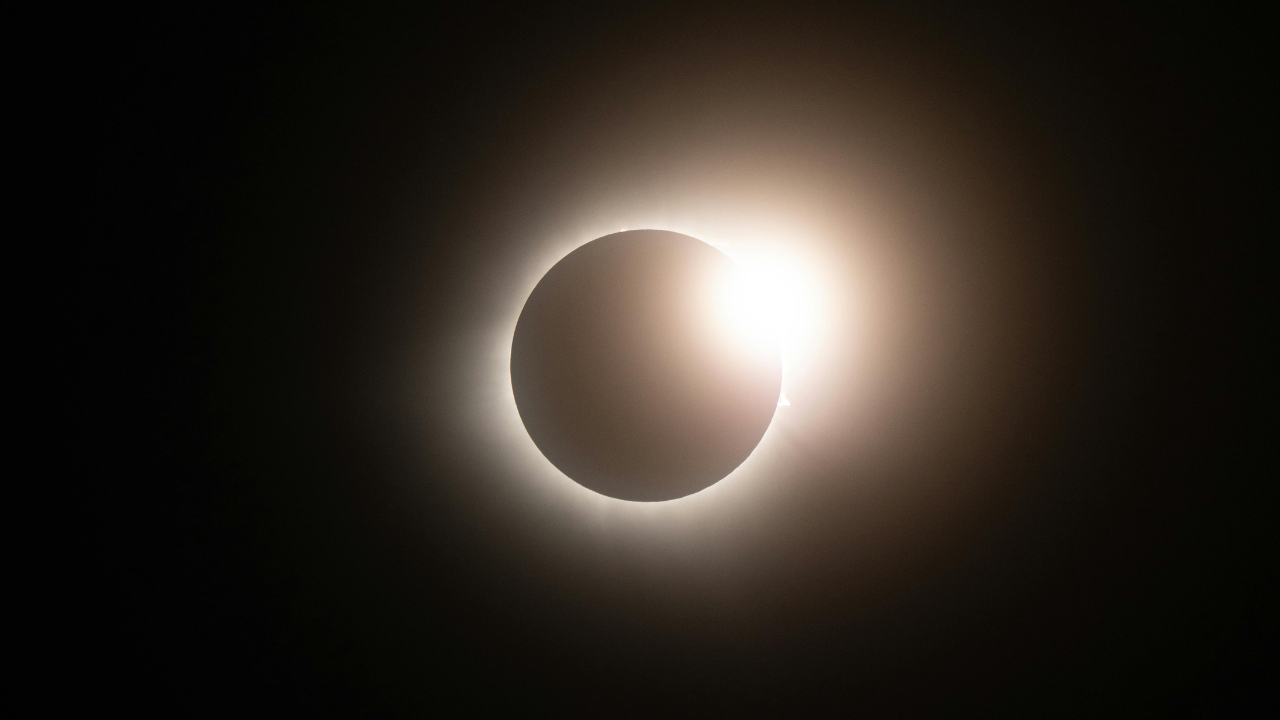
- Baily's Beads and the Diamond Ring Effect: These optical phenomena are highly brief during an eclipse of this magnitude. Baily’s beads occur as sunlight passes through lunar topography (valleys). Because the apparent size of the Moon is significantly larger than the Sun in this event, the transition at the second and third contact points is rapid along the centerline, concentrating the Diamond Ring effect into a sharp, highly defined burst of light.
Operational Logistics and Site Selection
Exploiting this event requires balancing the duration of totality against infrastructure capabilities and geographic realities. Maximizing observation time requires strict adherence to a three-tier logistical selection framework.
Tier 1: The Premium Hyper-Arid Sector (Luxor, Egypt)
Luxor represents the optimal intersection of maximum duration and robust infrastructure. At 6 minutes and 19 seconds of totality, it sits within 4 seconds of the absolute theoretical maximum of the eclipse path. The logistical footprint is supported by an international airport, river transport networks, and substantial hotel capacity. The high solar altitude (82°) eliminates terrain shadowing or obstruction from physical structures, allowing for uncompromised equipment placement.
Tier 2: The High-Duration Coastal Sector (Benghazi, Libya and Jeddah, Saudi Arabia)
Both locations cross the 6-minute totality threshold (6m 07s and 6m 02s respectively). Jeddah provides exceptional logistical access via modern transit networks and high hospitality capacity. However, coastal humidity elevates the risk of high precipitable water vapor columns in the atmosphere, which increases forward scattering and reduces the crispness of coronal photography compared to inland desert tracks.
Tier 3: The European Gateway (Tarifa and Cadiz, Spain)
While logistically frictionless for European observers, Spain offers a vastly reduced duration profile (between 1 minute 52 seconds in Malaga and 4 minutes 39 seconds in Tarifa). Solar elevation is lower (37° to 39°), increasing the atmospheric path length through which the light must travel (airmass factor $\approx 1.6$). This causes higher atmospheric extinction and a greater risk of coastal cloud deck interference.
A critical structural anomaly to factor into long-range planning is the path intersection phenomenon. The path of the August 2, 2027 total solar eclipse will be crossed less than seven years later by the path of the March 20, 2034 total solar eclipse. This intersection occurs directly over eastern Egypt, near Luxor. While the statistical probability of a total solar eclipse hitting any specific coordinate is roughly once every 375 years, this specific node offers a rare opportunity to reuse established baseline geodetic coordinates, atmospheric monitoring stations, and logistical supply chains for two high-magnitude events within a single decade.
The optimal deployment strategy demands positioning core observation teams within the Luxor-Sohag corridor of Egypt, prioritizing inland desert sites at least 15 kilometers away from the Nile River mirror to eliminate localized evaporation plumes and optimize thermal stability during the rapid cooling phase of totality.