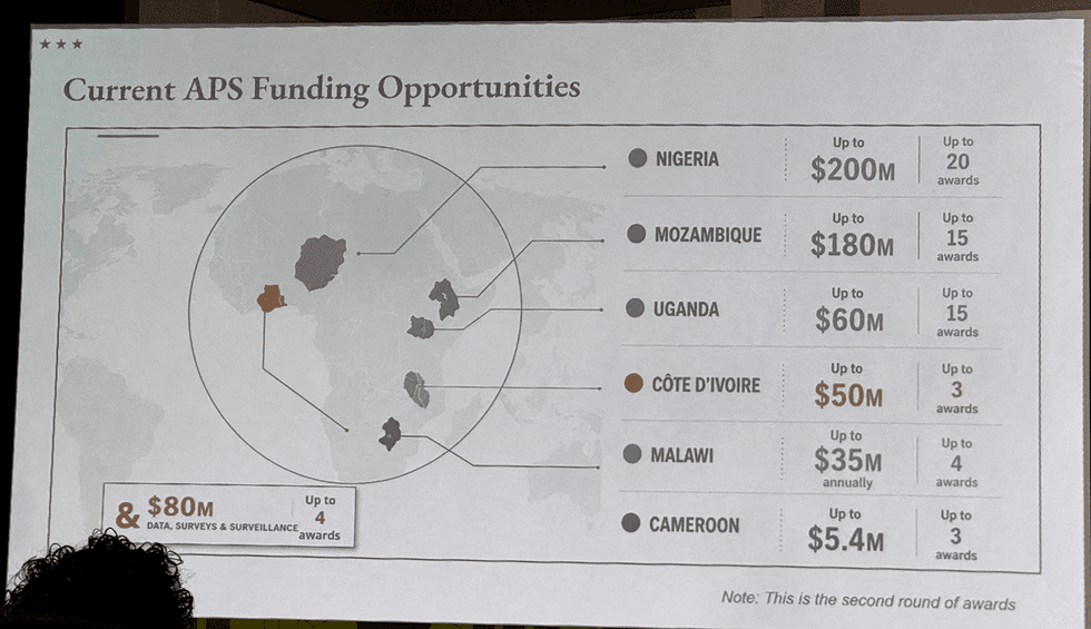
The ink was barely dry on the press release when the absurdity of it hit the digital ether. At the State Department—the very engine room of American diplomacy, the place where borders are negotiated, treaties signed, and global influence projected—someone looked at a map of Africa and saw a blank slate. Or, more accurately, a chaotic, jumbled mess where the identities of fifty-four sovereign nations had been effectively vacuumed away, replaced by a generic, uniform placeholder.
It was a geography teacher’s nightmare. It was a diplomat’s humiliation. If you found value in this article, you might want to read: this related article.
I remember sitting in a small office in Nairobi years ago, watching a cartographer painstakingly trace the borders of a newly recognized administrative district. He moved with the precision of a surgeon. For him, those lines were not just ink on paper. They were the bones of a nation. They represented history, blood, contested water rights, and the fragile promises made by leaders to their people. When you touch a border, you are touching the nerves of a population.
When the U.S. government released a map where every country in Africa was mislabeled or simply stripped of its unique designation, it wasn’t just a clerical error. It was an act of erasure. For another angle on this event, check out the latest coverage from TIME.
Consider the reality of a student in Lagos, or a business owner in Addis Ababa. When they look toward Washington, they look for a partner that sees them. They look for a superpower that understands the complexities of the continent—the difference between the Sahel and the savanna, the distinct political histories of Nigeria and Botswana. When that partner produces a graphic that effectively suggests Africa is a monolith, it sends a chilling message. It says: You are not worth the effort of getting it right.
The State Department quickly stepped forward, offering a standard, muted apology. They took "full responsibility." It’s a phrase designed to be an end-stop, a period placed at the end of an embarrassing sentence to signal that the conversation is over. But it ignores the structural vertigo such an error causes.
Mistakes happen. We are human. But there is a difference between a typo in a memo and a systemic failure in visual communication that touches upon the sovereignty of an entire continent. This was not a misplaced decimal point. This was a failure of institutional memory. It suggests a workspace where the people responsible for projecting American values abroad have lost sight of the very geography they are meant to engage with.
Imagine the workflow. A designer creates the file. An editor reviews it. A press officer signs off on the release. At every step of that journey, the map sat there, staring back at them. Did nobody see it? Did the eyes simply glide over the labels because, in their subconscious, the specific distinctions of these nations didn't matter enough to trigger a correction?
This is the invisible stake of global optics. We live in an era where trust is the primary currency of foreign policy. If you cannot get the names of the countries you are speaking to right, why should anyone believe you can manage the nuance of trade agreements, climate initiatives, or security partnerships?
The fallout was immediate, but the damage is deeper than a few mocking tweets or a news cycle’s worth of outrage. The error reinforced a tired, dangerous trope: that Africa is a singular, undifferentiated mass. It is a narrative that Western powers have fought for decades to overcome, trying to move past the colonial-era mentalities that once carved up the continent without regard for the people living there. To see that same disregard reflected in a modern government document is a jarring reminder that old habits of invisibility die hard.
We have to ask why this keeps happening. Is it a lack of resources? A lack of focus? Or is it something more insidious—a subtle, pervasive bias that treats some regions of the world as fundamentally less complex than others?
I have spent my life working in the gap between what policymakers in Washington believe and what the reality on the ground feels like. That gap is often filled with these small, careless omissions. When we prioritize speed over substance, when we treat the map as a background graphic rather than a sacred document of identity, we lose our way.
There is a weight to being a superpower. That weight is not just military or economic. It is the weight of being watched. Every document, every graphic, every statement is scrutinized by a world that is desperate for genuine connection and terrified of being forgotten. When we erase their names, we tell them they are ghosts.
The State Department will move on. They will issue updated graphics. They will implement new protocols. But the memory of that map remains. It exists now as a cautionary tale about what happens when an institution stops looking closely at the world it claims to lead.
It was never just about a few misplaced words on a digital image. It was about the gaze. And for a brief, glaring moment, that gaze looked at the heart of a continent and saw nothing at all.
There is a quiet, devastating power in realizing you have been rendered invisible by the very people who claim to be your closest allies. The map has been corrected, but the ink stain remains on the reputation of those who let it happen. The next time a diplomat walks into a room in a capital city across the Atlantic, they will have to work twice as hard to prove that they actually know where they are standing.
They will have to earn the right to draw the lines again. Because a map is more than a guide; it is a promise of recognition. And until that promise is kept with absolute, unwavering precision, the trust will stay buried under the weight of a continent that knows exactly who it is, even if the person holding the pen has forgotten.