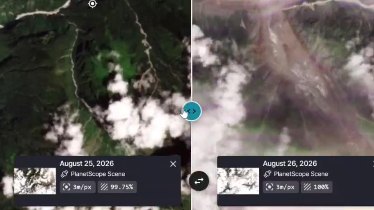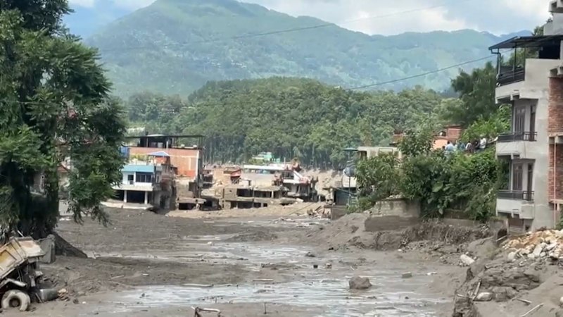
The water didn't rise gradually. It arrived as a violent, nine-metre wall that restructured the landscape in under thirty minutes.
When an ice-rock avalanche slammed into the Lhende Khola river basin near the Nepal-China border, it triggered a catastrophic chain reaction. The Bhote Koshi and Trishuli river systems transformed instantly from mountain streams into raging torrents of mud, debris, and boulders. At least 98 people have been confirmed dead across Nepal and China, while hundreds more remain unaccounted for.
If you look past the immediate shock of the disaster, a stark reality emerges. This isn't just an isolated act of nature. It’s a terrifying preview of what happens when high-altitude cryosphere destabilization meets booming regional tourism and infrastructure development.
The Anatomy of a Himalayan Flash Flood
Understanding how a mountain slope thousands of meters up can wipe out downstream communities requires looking closely at the mechanics of the event. On Wednesday morning at around 9 a.m. local time, a massive mass of glacial ice and rock detached.
Scientists at the International Centre for Integrated Mountain Development point to this ice avalanche as the primary trigger. The debris crashed into a narrow section of the river, creating a temporary landslide dam. Water pooled behind this unstable barrier until the pressure became too great. When the natural dam burst, it unleashed a colossal surge of water that caught entire villages, roads, and hydropower projects completely off guard.
Hydrological stations recorded staggering anomalies. The Trishuli River at Galchchi rose by nine metres in a single half-hour window. You cannot outrun that kind of velocity. Multi-story buildings in districts like Rasuwa and Nuwakot were buried under thick layers of silt, while vehicles and bridges vanished.
Who Was Caught in the Path
The human toll of this disaster extends far beyond local residents. The timing coincided with heavy travel periods for international pilgrims and trekkers.
According to the Nepal Tourism Board, hundreds of travellers are among the missing. This includes over 100 Indian nationals—many journeying toward sacred pilgrimage routes in Tibet—alongside tourists from the United States, the United Kingdom, Australia, Malaysia, Canada, and South Korea. Local populations celebrating regional festivals and workers stationed at vulnerable hydroelectric facilities along the river corridors were hit just as hard.
Rescue operations are currently facing immense hurdles. Helicopters are struggling to navigate unstable weather, and ground teams are fighting through meters of heavy grey mud that swallowed roads near the border. Governments in India and China have mobilized support, sending emergency response teams and coordination units to assist the Nepali authorities.
Why the Mountains Are Breaking Down
We need to talk about the underlying crisis. The Himalayas are warming faster than almost any other mountain ecosystem on earth.
Rising global temperatures weaken permafrost, destabilize hanging glaciers, and turn solid rock slopes into ticking time bombs. This exact region experienced a similar warning shot last year when an overflowing glacial lake breached its banks. Yet, regional development has outpaced hazard mapping. Hydropower plants, roads, and tourism hubs continue to crowd narrow river valleys because these corridors offer the only viable pathways through jagged terrain.
When planners build infrastructure in active cryosphere zones without accounting for high-altitude avalanches or outburst floods, catastrophes become inevitable rather than accidental. Traditional monsoon tracking systems are useless when a disaster originates from a frozen wall of ice collapsing miles upstream.
What Needs to Change Right Now
Emergency relief is the priority today, but systemic changes must follow if we want to prevent future tragedies of this magnitude.
- Real-Time High-Altitude Monitoring: Governments must deploy automated seismic and hydrological sensors near glacial lakes and unstable slopes rather than relying on downstream visual sightings.
- Stricter Zoning Laws: Riverbanks in the Bhote Koshi and Trishuli basins need enforceable buffer zones where permanent heavy infrastructure and high-density tourist camps are restricted.
- Cross-Border Data Sharing: Because these river systems originate in Tibet and flow into Nepal, seamless hydrological data sharing between Beijing and Kathmandu is non-negotiable for early warning systems to work.
If you have family members or friends travelling through the Rasuwa, Nuwakot, or Dhading districts of Nepal, check official advisories immediately. The Nepal Tourism Board has established emergency contact channels, including hotline numbers and tourist police desks, to help families track missing persons. Stay away from swollen Himalayan riverbanks, because secondary blockages upstream continue to pose active threats to anyone downstream.