The Mechanics of Systemic Failure
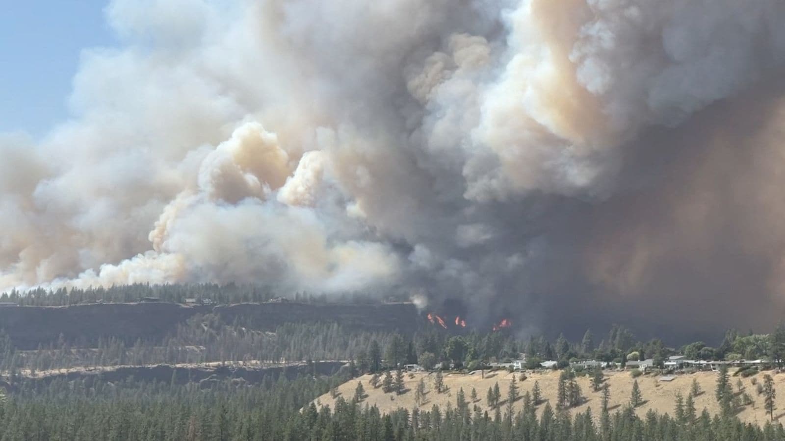
Wildfire events in the Pacific Northwest operate as complex cascading systems rather than isolated meteorological anomalies. When severe blazes strike Washington State, forcing widespread evacuations and crippling electrical grids, standard media coverage typically defaults to descriptive panic: smoke density, acreage burned, and displaced populations. This reporting model fails because it treats symptoms as primary variables.
An analytical deconstruction requires shifting focus from the fire front itself to the underlying vulnerability matrices that convert environmental triggers into socio-economic paralysis. The primary driver of catastrophic evacuation and infrastructure failure is not flame velocity alone, but the convergence of aging grid architectures, high fuel load densities accumulated through historical fire suppression, and localized topography that accelerates wind vectors through narrow river canyons.
[Environmental Trigger: High Winds / Dry Fuel]
                     │
                     ▼
[Infrastructure Node: Overhead Power Line Failure]
                     │
                     ▼
[Grid Cascade: Substation Isolation & Blackouts]
                     │
                     ▼
[Systemic Bottleneck: Evacuation Paralysis & Comms Blackout]
To understand why a regional burn transforms into a state-level crisis, one must evaluate the operational thresholds of three distinct sub-systems: energy transmission, evacuation logistics, and emergency communications. Each system possesses specific failure points that dictate the severity of the human and economic toll.
The Energy Infrastructure Vulnerability Matrix
Electrical grids in forested regions represent a dual-threat vector. They serve as primary ignition sources when wind-stressed conductors contact dry timber, and they represent immediate collateral damage points when radiant heat deforms transmission towers or shorts substations.
+---------------------------+-----------------------------------+------------------------------------------+
| Grid Component            | Vulnerability Mechanism           | Systemic Impact                          |
+---------------------------+-----------------------------------+------------------------------------------+
| Overhead Distribution     | Conductor swing and tree contact  | Primary ignition source during high winds|
| Substations               | Particulate accumulation / heat   | Automated trip-outs leading to blackouts |
| Communication Backhaul    | Loss of commercial grid power     | Cellular tower battery exhaustion        |
+---------------------------+-----------------------------------+------------------------------------------+
When utility providers execute preemptive public safety power shutoffs to mitigate ignition risks, they introduce a secondary operational hazard: the immediate loss of functionality in municipal water pumping stations, traffic signaling networks, and residential well pumps.
The systemic trade-off is stark. Maintaining electrical flow during high-wind, low-humidity events risks catastrophic wildfire ignition. Severing electrical flow prevents ignitions but immediately blinds emergency management systems and halts localized fire suppression capabilities dependent on electric pumps.
Regional transmission operators manage this through deterministic risk thresholds, yet localized micro-climates frequently exceed predictive models. Vegetation management backlogs compound this vulnerability. When clearance zones beneath high-voltage lines fail to account for root-zone moisture stress and accelerated tree mortality from beetle infestations, the threshold for physical line failure drops significantly.
Evacuation Bottlenecks and Route Economics
Population displacement during a rapid-onset wildfire follows the principles of network flow optimization, constrained severely by geographic limitations. Washington State’s distinct topography—characterized by mountain ranges, deep river valleys, and limited highway corridors—creates constrained egress routes.
When evacuation orders are issued simultaneously across an entire county, traffic demand instantly exceeds the nominal capacity of rural arterial roads. This creates spatial queues that convert mobile populations into stationary targets.
[Simultaneous Evacuation Order]
               │
               ▼
[Capacity Deficit: Single-Lane Arterial Roads]
               │
               ▼
[Queue Formation & Vehicular Stalling]
               │
               ▼
[Evacuation Failure / Trapped Populations]
Human behavioral variables dictate the degradation of evacuation efficiency:
- Perception Latency: The time interval between official warning issuance and physical movement initialization. Delayed departure concentrates demand curves into an unmanageable spike.
- Information Asymmetry: Discrepancies between official evacuation polygons and real-time fire progression reports lead to route selection errors, driving evacuees toward active fire perimeters.
- Asset Availability: High reliance on private vehicular transport results in systemic failure for non-driving demographics, elderly populations, and households lacking functional transport assets.
Economic stratification directly dictates survival probability. Households with high adaptive capacity possess the financial liquidity to secure temporary lodging outside the hazard zone immediately, while resource-constrained populations rely heavily on public mass-shelter infrastructure, which often experiences its own logistical distribution delays.
Communication Network Degradation
Information integrity degrades rapidly during major fire events. Cellular infrastructure depends on commercial power grids. When fires sever transmission lines and backup diesel generators exhaust their fuel reserves—or fail due to particulate clogging of air intake filters—cell sites drop offline sequentially.
This creates localized communication blackouts precisely when real-time telemetry is most critical for emergency responders and civilian navigation.
Without redundant satellite mesh networks or hardened local radio links, communities face informational isolation. Evacuees attempting to access digital maps find cellular data speeds throttled or networks entirely saturated, forcing reliance on visual cues and word-of-mouth intelligence. This informational void accelerates panic-driven behavior, undermining structured evacuation staging.
Strategic Resource Allocation and Suppression Limits
Wildfire suppression economics are governed by diminishing marginal returns. Initial attack strategies deployed within the first operational operational window achieve high containment efficacy at low cost. However, once a fire breaches containment lines and transitions into an unmitigated crown fire driven by erratic wind vectors, suppression tactics shift from active containment to defensive asset protection.
Aerial firefighting assets face strict operational boundaries:
- Visibility Constraints: Heavy smoke density and ash plumes restrict visual flight rules, grounding fixed-wing tankers and rotorcraft.
- Wind Shear Limits: High-velocity crosswinds in complex mountain terrain render chemical retardant drops ineffective before the agent reaches the fuel bed.
- Turnaround Latencies: The distance between active fire fronts and suitable water or retardant reload bases limits sortie frequencies during prolonged burn periods.
Consequently, emergency management agencies must execute triage protocols, prioritizing high-density structural zones over remote timberland. This triage model, while mathematically rational for loss minimization, accelerates ecological degradation in unprotected sectors and increases long-term watershed vulnerability.
Long-Term Watershed and Economic Cascade
The termination of active flame fronts does not signal the end of the crisis lifecycle. Post-fire landscapes introduce severe secondary hazards that persist for years.
[Wildfire Event]
       │
       ▼
[Vegetation Destruction & Soil Hydrophobicity]
       │
       ▼
[Precipitation Event]
       │
       ▼
[Debris Flows & Reservoir Siltation]
The destruction of organic matter creates a hydrophobic soil layer, preventing water infiltration. Subsequent precipitation events trigger severe debris flows, flash floods, and massive soil erosion. These hydrological shocks scour riverbeds, destroy downstream bridges, and overwhelm municipal water treatment facilities with high concentrations of sediment, ash, and heavy metals.
Insurance markets respond to these cumulative risks through structural premium escalation or complete market withdrawal in high-hazard zones. As underwriting models adjust to increasing event frequencies, property valuations decouple from historical norms, forcing a structural reassessment of residential development patterns in the wildland-urban interface.
Strategic Operational Forecast
Mitigating recurring state-wide evacuation failures requires moving beyond reactive emergency response toward structural network hardening.
Regional infrastructure operators must accelerate the undergrounding of distribution lines in high-risk corridors, implement automated sectionalizing switches to isolate faulted zones instantly without widespread blackouts, and enforce strict defensible space compliance backed by geospatial auditing.
Simultaneously, transportation authorities must deploy modular, reversible lane configurations on critical rural evacuation routes to double outbound capacity during emergency events. Without these capital-intensive structural interventions, recurring environmental triggers will continue to expose systemic vulnerabilities, converting natural weather events into predictable humanitarian crises.