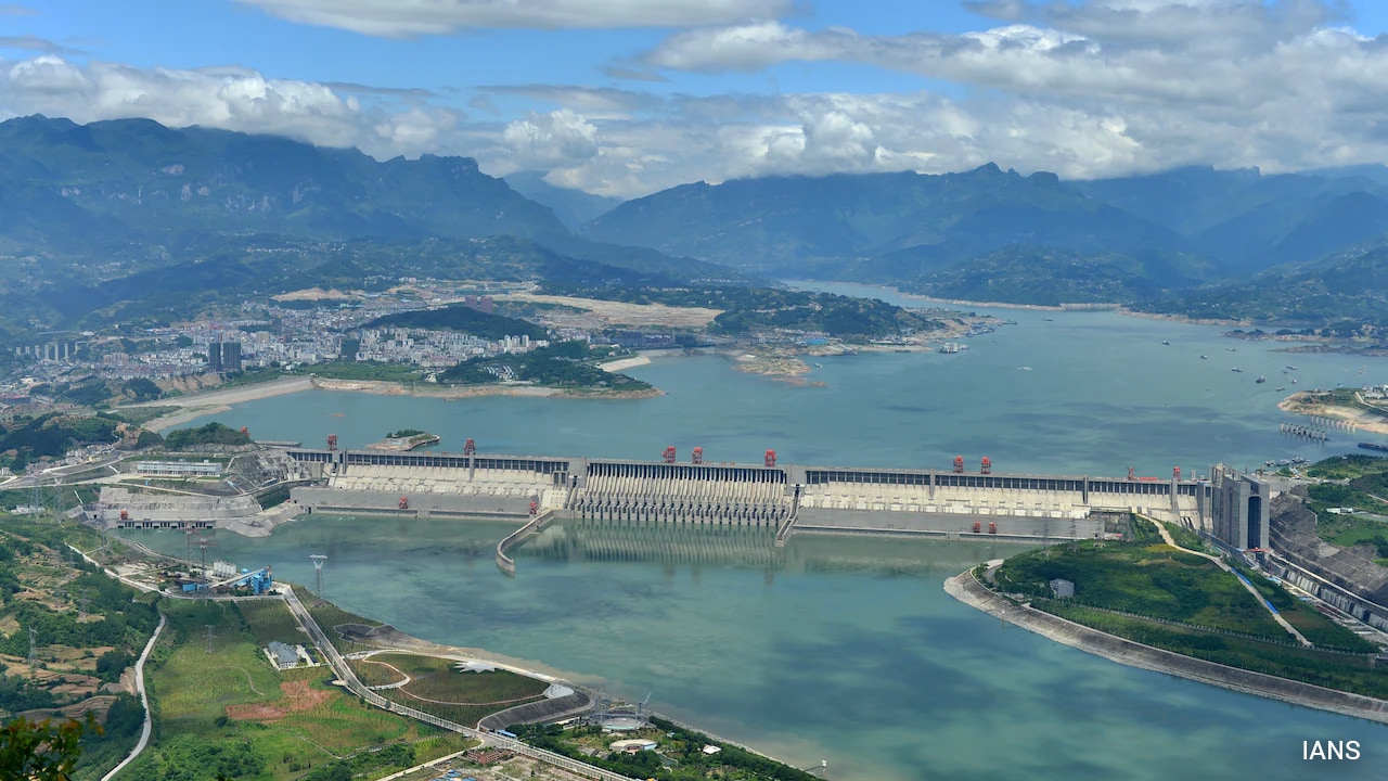
The development of the 60,000-megawatt Medog Hydropower Project on the Yarlung Tsangpo River in Tibet represents an unprecedented scale of civil engineering. Projected to generate approximately 300 billion kilowatt-hours of electricity annually, the project relies on the extreme kinetic energy generated by a 2,000-meter vertical drop over a 50-kilometer distance at the river's Great Bend. However, recent scientific findings published by geologists affiliated with the state-run China Geological Survey reveal that the dam's footprint intersects directly with the active Paizhen Fault. Evaluating the structural integrity of this project requires analyzing the mechanical stress, seismic vulnerability, and downstream hydrological risks through a strict geomechanical and risk-mitigation framework.
The Triad of Geomechanical Vulnerability
The engineering feasibility of the Medog project is constrained by three compounding geological variables that define the site's structural risk profile.
1. Active Fault Discontinuity
The Paizhen Fault runs directly beneath the primary reservoir and infrastructure zone. Data from Quaternary tectonic analysis indicates this fault has remained active from the Early Pleistocene through the Holocene epoch, with documented activity as recently as 9,500 years ago. The fault line represents a permanent structural discontinuity in the bedrock. When engineering a run-of-the-river or reservoir-based megastructure, an active fault introduces the risk of differential displacement, where the ground on one side of the fracture moves independently of the other. This movement delivers shear stress directly to concrete foundations, bypassing standard seismic dampening systems designed for uniform ground shaking.
2. Degraded Rock Mass Rating (RMR)
Centuries of seismic activity along the plate boundary—driven by the ongoing collision of the Indian and Eurasian tectonic plates—have mechanically altered the surrounding lithology. The rock formations within the Paizhen area exhibit high fracturing, low cohesion, and a loose structural matrix. In rock mechanics, a low Rock Mass Rating significantly degrades the foundation's bearing capacity. The fractured bedrock reduces the shear strength of the abutments, meaning the natural rock walls are poorly equipped to resist the lateral hydrostatic pressure exerted by a massive water column.
3. Reservoir-Induced Instability
The construction plan introduces a critical operational bottleneck: the interaction between fractured lithology and high-pressure fluid mechanics. Once the reservoir fills, the surrounding slopes will experience long-term immersion. This creates a dual destabilizing effect:
- Pore Pressure Elevation: Water infiltrating the fractured rock mass increases internal pore water pressure, which reduces the effective stress and friction along existing joints.
- Lithological Softening: Prolonged saturation chemically and mechanically weakens the cohesion of the loose slope material, accelerating mass wasting processes.
Seismic Trigger Mechanisms and Mass Wasting
The primary structural risk is not limited to static load failures; it is magnified by dynamic seismic triggers common to the Himalayan belt, such as the magnitude 6.9 earthquake that struck nearby Milin in 2017. The interaction between seismic acceleration and saturated, low-cohesion slopes generates a predictable chain of physical causation.
[Seismic Detonation / Fault Slip]
               │
               ▼
[Dynamic Shear Stress Exceeds Low Cohesion Threshold]
               │
               ▼
[Massive Rock Avalanche / Landslide Into Reservoir]
               │
               ▼
[Displacement Wave / Megatsunami] ──► [Overtopping / Dam Failure]
This sequence illustrates the mechanism of a landslide-induced displacement wave. If an earthquake triggers a high-volume slope failure into a deep reservoir, the kinetic energy transfer produces a displacement wave capable of overtopping the dam crest. For concrete structures, overtopping causes severe scabbing and erosion at the toe; for embankment elements, it causes rapid internal erosion, leading to catastrophic structural breach.
Downstream Hydrological Shock and Boundary Limitations
The physical stability of the Medog project directly dictates the environmental and physical security of lower riparian zones, specifically India’s state of Arunachal Pradesh (where the river enters as the Siang) and Bangladesh (where it becomes the Jamuna). The downstream risk profile operates under two distinct modalities.
Transboundary Sediment Interception
The Yarlung Tsangpo Grand Canyon acts as a primary global sediment conveyor. Mechanical erosion within this canyon contributes roughly 45 percent of the total sediment volume that populates the Brahmaputra River basin. A dam at this juncture introduces a physical barrier that alters the river's transport dynamics.
The structure traps heavy gravels and nutrient-rich silts within the reservoir basin. The discharge water, stripped of its sediment load, becomes "hungry water." This clear water possesses excess kinetic energy, causing accelerated riverbed degradation and severe bank erosion downstream in Assam. Furthermore, the reduction in downstream silt deposition directly diminishes the agricultural fertility of the floodplains, disrupting local food production systems.
Operational Flow Volatility
While the Brahmaputra’s total annual volume is heavily supplemented by monsoon rainfall and tributaries within Indian territory, the upper riparian infrastructure dictates the baseline flow during the dry season. The operational strategy of a 60-gigawatt facility requires peaking operations—holding back water during periods of low demand and releasing massive volumes during peak electricity usage hours. This operational cycle creates artificial diurnal tides downstream, disrupting riverine ecosystems, destroying fisheries, and invalidating traditional flood-warning timelines relied upon by local populations.
Engineering Safeguards and Technical Constraints
To mitigate the identified Paizhen Fault risks, project engineers must apply extreme structural reinforcement techniques. Standard civil designs are insufficient for a structural matrix with weak cohesion and active faulting.
Foundation Grouting and Shear Keys
To counteract the low bearing capacity of the fractured bedrock, extensive consolidation grouting is mandatory. High-pressure chemical and cement grouting must be injected into the rock mass to fill the fracture networks, artificially increasing the rock's cohesion and compressive strength. Additionally, deep concrete shear keys must be excavated across the fault zone to anchor the dam structure into deeper, unfragmented strata, distributing the lateral hydrostatic loads across a broader geological footprint.
Active Slope Stabilization
The reservoir slopes require extensive structural remediation to prevent the landslide-overtopping sequence. This involves installing deep, post-tensioned anchors into the hillside to mechanically clamp the loose rock layers together. These anchor networks must be coupled with heavy shotcrete linings and comprehensive internal drainage networks to prevent the buildup of destabilizing pore water pressure during long-term immersion.
The fundamental limitation of these engineering interventions is that they operate on a deterministic model, whereas seismic events are probabilistic and stochastic. While grouting and rock anchors mitigate minor to moderate geological shifts, they cannot guarantee structural integrity against a major surface fault rupture occurring directly beneath the dam core. A multi-meter offset during a severe tectonic event exceeds the elastic deformation limits of reinforced concrete, establishing a finite boundary condition to the efficacy of structural engineering safeguards.
Strategic Asset Realignment
Given the geomechanical constraints identified by state geologists, the optimal tactical pathway for upstream management requires a shift from a single mega-reservoir architecture toward an distributed, ultra-deep tunnel diversion model. By minimizing the height and volume of the main retaining barrier and relying on subsurface power-generation tunnels driven through competent rock blocks away from the core fault line, engineers can capture the 2,000-meter head potential while reducing the total hydrostatic load and reservoir-induced seismic risk. Lower riparian states must concurrently fortify downstream embankments and deploy advanced, satellite-linked hydrological monitoring arrays along the border to counter the realities of altered sediment and flow regimes.